Predicts the wet-bulb globe temperature on a pinpoint basis in a short time to prevent heatstroke.Simulation of Countermeasures against Heatstroke
- Disaster prevention
Jointly with Kobe University and the Integrated Engineering System Research and Development Partnership, we developed a system for use as countermeasures against heatstroke; the system calculates the temperature, wind velocity, and wet-bulb globe temperature at a single location in a short amount of time (about 1 day) by using MSSG,*1 which was developed by the Japan Agency for Marine-Earth Science and Technology (JAMSTEC).
*1: MSSG (Multi-Scale Simulator for the Geoenvironment) calculates the temperature, wind velocity, humidity, atmospheric pressure, radiant heat, and other information at high resolutions by using a supercomputer (Earth Simulator of JAMSTEC) to obtain the wet-bulb globe temperature (WBGT).
Micrometeorology calculation at high resolutions
Generally, the results of wet-bulb globe temperature*2 prediction in municipal areas (e.g., Hachioji in Tokyo, Maebashi in Gunma) are often presented on an hourly basis. On the other hand, MSSG executes micrometeorology calculations at extremely high resolutions that include a spatial resolution of 5m and a temporal resolution of 10 seconds. Therefore, the system can predict fine temporary changes in temperature, wind velocity, WBGT, and other information for use as countermeasures against heatstroke during outdoor work at a power station or factory as well as at a variety of locations, including theme parks and other outdoor events.
*2: The wet-bulb globe temperature (WBGT) is an index proposed for the purpose of preventing heatstroke. This index focuses on the heat balance between the human body and the outer air and is affected not only by air temperature but also by humidity and the surrounding heat environment.
https://www.wbgt.env.go.jp/wbgt.php
-
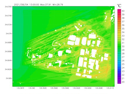
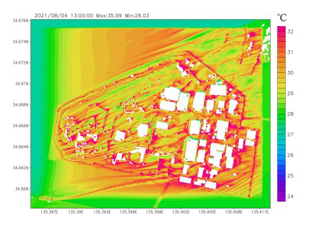
Predicted temperature distribution in actual city blocks (as of 13:00) -
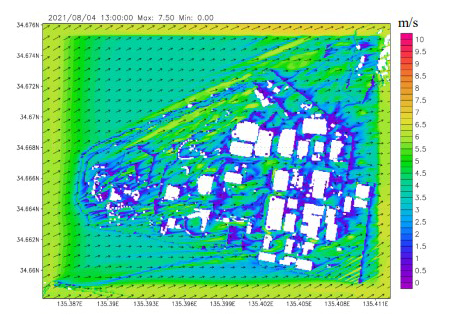
Predicted distribution of wind velocities/wind directions in actual city blocks (as of 13:00)
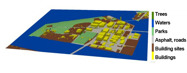
Automatic creation of input data for MSSG based on PLATEAU data
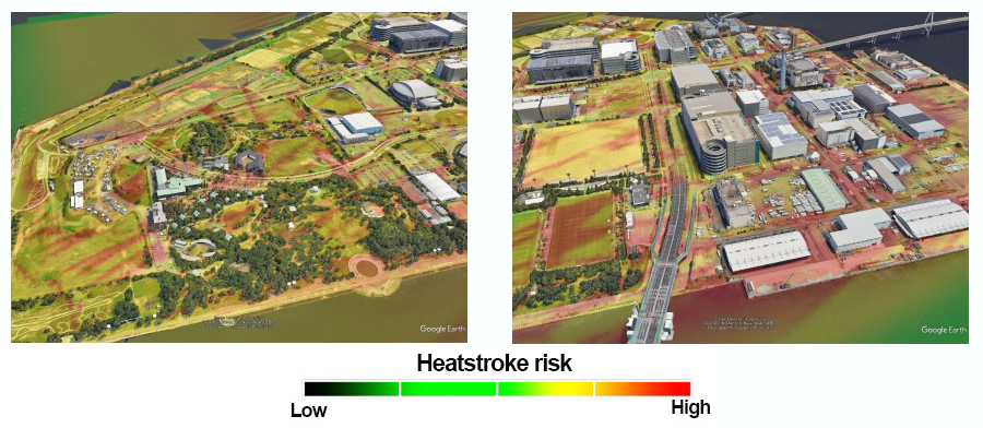
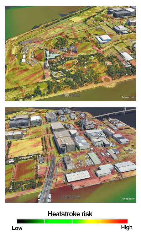
As automatic data conversion/integration technology, the Data Processing Platform (DPP) has been developed by RIKEN. In a joint collaborative project with Kobe University and the Integrated Engineering System Research and Development Partnership, we developed a system that imports data from PLATEAU*3 of the Ministry of Land, Infrastructure, Transport and Tourism to DPP and almost automatically outputs the entered data for use in micrometeorology calculations conducted by MSSG. Through the use of this system, it is possible to extract the land use classification, building height, ground surface height, and tree height of an arbitrary selected calculation-target area from the PLATEAU data being developed nationwide in order to allow MSSG to execute the micrometeorology calculation.
We are implementing accuracy checks of the results of heatstroke simulations by MSSG for further improvement of the simulations jointly with the Integrated Engineering System Research and Development Partnership as part of the SIP Project (Strategic Innovation Creation Program of Establishment of Smart Infrastructure Management System by the Cabinet Office).*4
*3: PLATEAU is a nationwide urban digital twin realization project in Japan led by the Ministry of Land, Infrastructure, Transport and Tourism. In order for everyone to freely extract urban digital data, 3D urban models are provided as open data.
https://www.mlit.go.jp/plateau/
*4: The details of the SIP research project (sub subject, themes, and topic) are as follows:Sub-subject D: Establishment and utilization of a common platform as an infrastructure database that integrates the cyber and physical spaces
Research and development themes: “Establishment of Digital Twin Operation Platform”; “Development of Platform Technology that Automatically Converts Various Infrastructure Data”
Research topic: “Urban Micrometeorology Simulation”
https://www8.cao.go.jp/cstp/gaiyo/sip/sip_3/keikaku/09_smartinfra.pdf
-
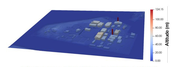
Urban data for MSSG extracted from PLATEAU (ground altitude and building altitude)Altitude (m) -
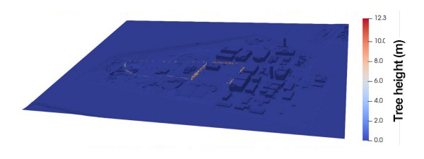
Urban data for MSSG extracted from PLATEAU (tree height)Tree height (m)