Agile operation even with big data sets for whole factories, entire regions, and moreTEPSCO Web3D Viewer
- IT & DX
- Maintenance & Management
This is TEPSCO’s own unique 3D viewer that we have created just from web technologies. It is browser-based and enables 3D data to be quickly and easily shared, meaning that the same 3D data can be used by everyone.
TEPSCO Web3D Viewer provides a wide range of functions that envisage use in existing facilities, completed buildings, and in equipment maintenance and management work, making it highly recommended for use by operators of factories, power plants, and other such facilities.
Build a 3D Environment for Multiple Users and Streamline Your Business!
Be sure to check out Web3D Viewer from TEPSCO if:
- You are having difficulty working out how best to store continuously growing point cloud data
- You have no environment in place for working quickly and easily with 3D
- You have massive amounts of data that can’t be stored on PCs, meaning you can’t use it when you want to
- You also want to use delivered BIM data in maintenance and management work
This solution is a service that provides a 3D digital data platform for building a 3D digital twin environment according to your needs and environment.
Key Features
- Simple and easy perspective shifting
- Hybrid display
- Handling and swift display of big data
- Long-term data management
Simple and easy perspective shifting
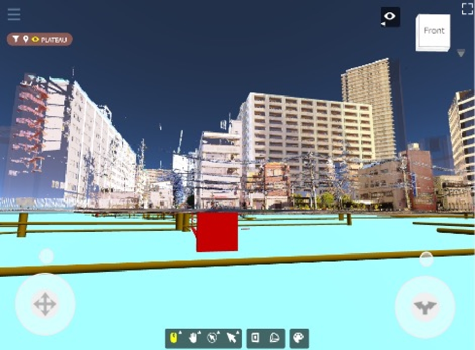
Assuming use by persons who are not familiar with 3D, Web3D Viewer’s simple operation includes pad-based perspective shifting and double click to instantly change location.
Handling and swift display of big data
The workload on the viewer is held down by splitting 3D data and saving a small file for each component, enabling the handling and swift display of big data.
Hybrid display
Web3D Viewer is capable of overlaying and displaying 3D models created with BIM or CAD software, cloud point data obtained with a 3D laser scanner or other device, and 360° panoramic photos*1 from a Ricoh THETA® or other camera.
(*1) 360° panoramic photos will be supported from the release scheduled for around the 2nd quarter of FY2024
Long-term data management
The long-term use of data is possible thanks to the adoption of the manufacturer-independent gITF*2 data format. Web3D Viewer provides a convertor to change Autodesk® Navisworks® and IFC 3D models as well as LAS, PTS, and E-57 cloud point data to Viewer format.
(*2) gITF is an open format that is mainly used in the display of 3D content in web browsers, and is an ISO international standard that aims to create a format that is the “JPEG of 3D.”

Standard Functions
-
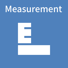
Measure things such as the distance between two points in a point cloud and a 3D model -
Name and save a selected portion of a space, and then retrieve it with a single press of a button -

Name and save a camera position, and then retrieve it with a single press of a button -

Place points with numerical data, and visualize data by color and point size*3 -
Use planes to visualize a voxel (a set of 3D objects laid out in a space)*3 -
Freely place 2D drawings (SVG format)*3 -

Register a comment or file (PDF, photo, video) at any desired point*3 -

Place a 360° photo taken and shift the viewpoint as if in street view*3 -

Display or hide objects that meet set criteria with a single press of a button -

Download a cross-sectional area of a 3D model or point cloud data in glb or E-57 format*3
(*3) To be released around the 2nd quarter of FY2024
(*4) Point of interest
The target object is
hidden by a voxel and hard to see
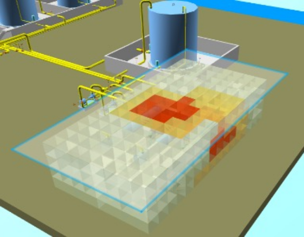
Not only can the voxel be made semi-transparent,
but the relation with the target object can be made clear
by displaying a contour drawing in the desired plane
Extended Functions
Simple BIM
Enter basic shapes and assign attributes in the viewer*5
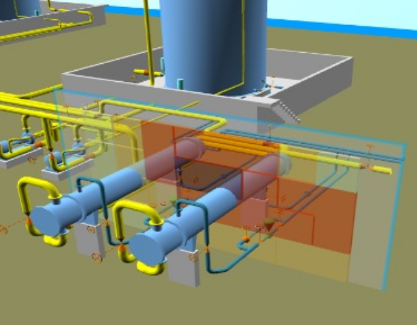
Simulator
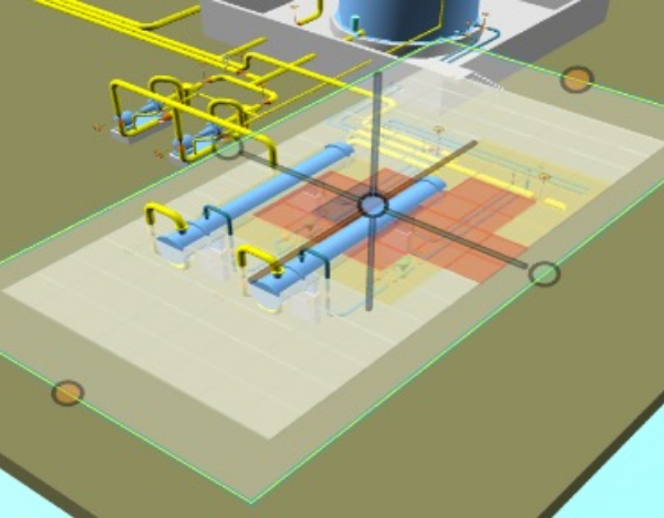
Move an area enclosed by a box to a desired location and check where interference occurs*5
Cross aggregation
Aggregate attributes in an area shown in the viewer as if using Excel pivot aggregation*5
Traceability
Replace a portion of a 3D model or otherwise swap out cloud point data in any area in the viewer, and keep records of such actions as history information*5
(*5) Currently in development with the aim of release in FY2025
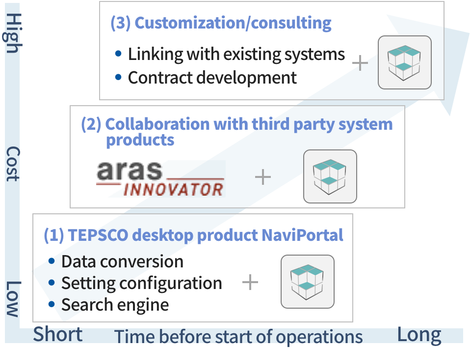
Service Provision Options
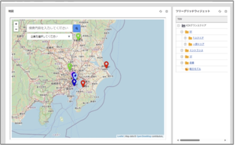
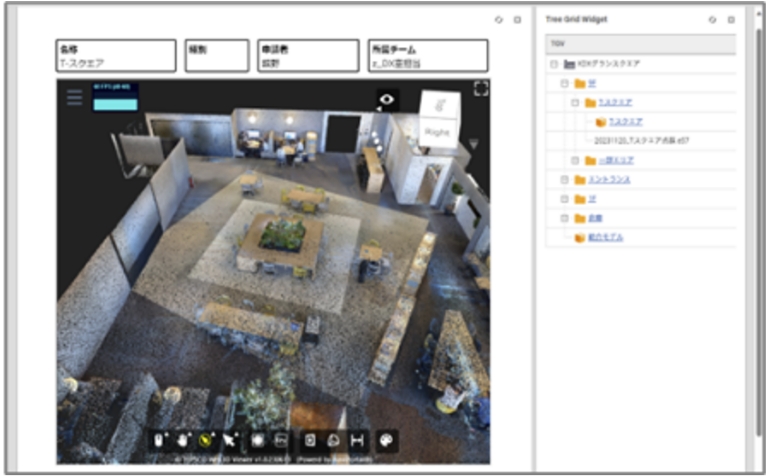
- (1) Via TEPSCO’s NaviPortal multi-viewer search software
- (2) Embedding in existing web systems
- (3) A range of other execution environments depending on your needs
The JavaScript API is available for use, so you are free to customize the service for your own purposes.
Implementation Example
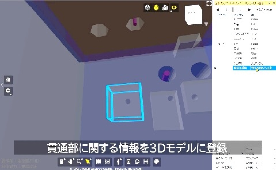
Nuclear Power Plant Penetration Points in Building Configuration Management System
- Ability to check tens of thousands of penetration points without omissions is limited
- BIM adopted as a new mechanism for 3D management of penetration points
- TEPSCO viewer used for penetration point BIM display screen
A Solution Linked to Aras Innovator
We are currently developing a 3D digital data platform fused with PLM*6 system Aras Innovator, highly regarded as a low-code platform. Scheduled for release around FY2025.
(*6) Product Lifecycle Management